Journal articleFree to read
Features of the geological structure and prospects of the oil and gas potentiality of the Khorezm region
Особенности геологического строения и перспективы нефтегазоносности Хорезмского региона
- Uzbekgeofizika JSC, Tashkent, Uzbekistan
Highlights
- Four deep wells; drilling density 1.67 m/km², or 1,684.0 km² per well.
- 2D CDP seismic and electrical surveys since 2020 over 4,870 km².
- Cretaceous thickness: 900–1,000 m in the north of the oasis to 1,400–1,500 m in the south; 1,100–1,200 m in the east to 1,300–1,400 m in the west.
- Jurassic thickness: 148 m at Yangibazar, 340 m at Yangiaryk, 450 m at Aksuy; 1,000–1,100 m in the southern trough, including Lower Jurassic up to 350–400 m.
- Permo-Triassic: absent in the north-east and east, up to 1,400–1,500 m in the south; 1,135 m drilled in well Yangiaryk 1.
- Palaeozoic rocks at 2,300–2,400 m in the east (Khazarasp, Yangibazar) and as deep as 4,300–4,400 m in the south.
- Gas reservoirs of the Achak and North Achak fields in Turkmenistan: sands with 15–20% porosity.
- Proposed parametric well: 4,000 m deep, with 700–750 m of Jurassic and 800–900 m of Permo-Triassic forecast.
Abstract
The article presents some results of CDP seismic surveys to study the deep geological structure of the Khorezm region, the prospects for oil and gas content of the Cretaceous and Jurassic deposits. Time sections are presented that characterize the features of the reflecting boundaries and structural maps along the surface of the Jurassic deposits.
English abstract from the journal issue PDF. The authors’ abstract, reproduced under .
In plain English
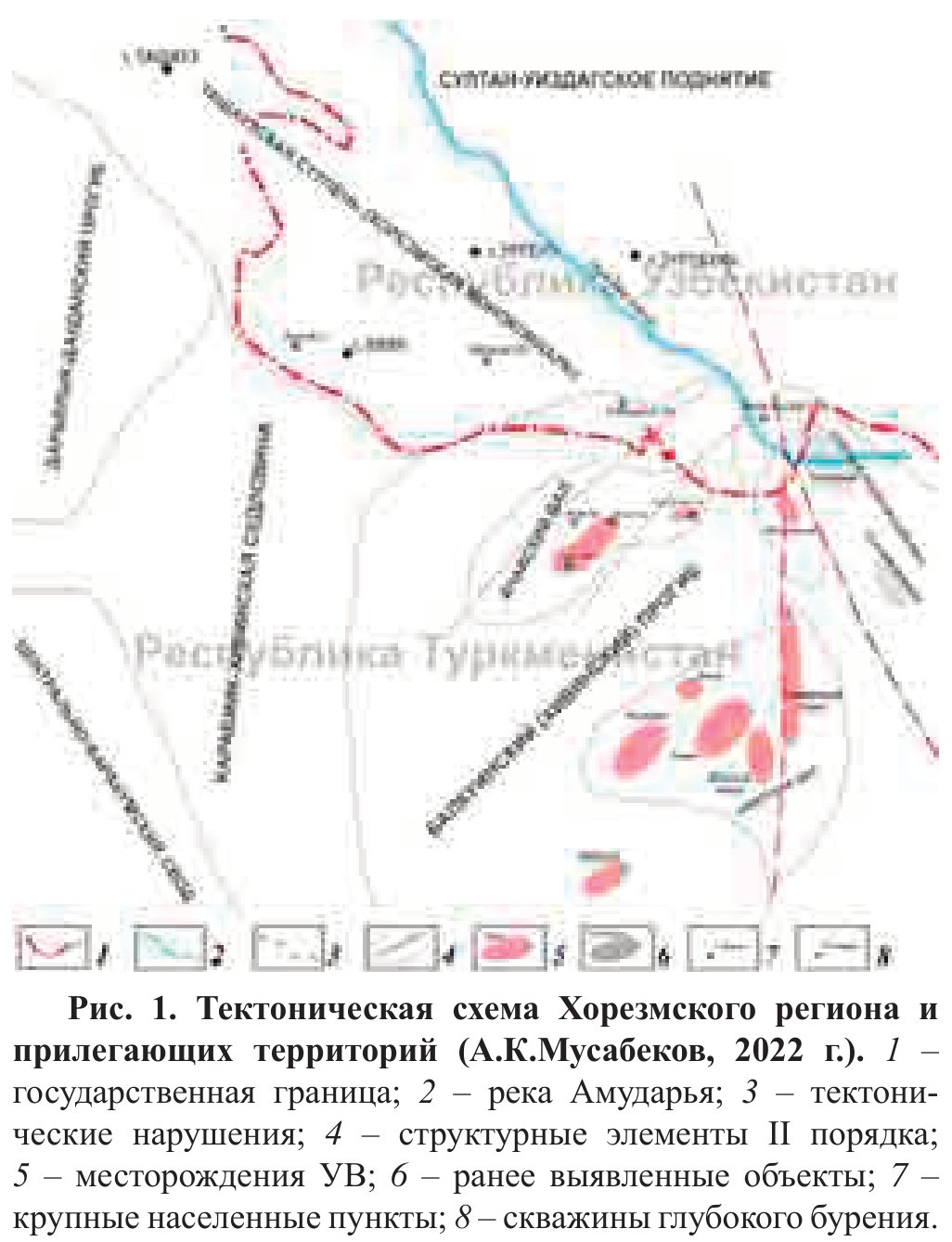
Written for oil and gas, this paper describes the deep structure of the Khorezm region in the north-western part of the Amu Darya depression. The region borders the Bukhara–Khiva oil and gas region to the east and the Aral–Ustyurt region to the north-west, and adjoins Turkmenistan to the south-west. Its tectonic elements include the Balkuin, Daryalyk–Daudan and Zaunguz troughs, several swells and the Karabiik–Khiva saddle. Only four deep wells have been drilled to study the section: Aksuy 1, Khorezm (Yangi-Aryk) 1OP, Khazarasp 1P and Yangi-Bazar 1P, a drilling density of 1.67 m/km². Tests of permeable horizons in these wells gave no inflow of oil or gas. Since 2020, 2D CDP seismic surveys combined with electrical and magnetotelluric soundings have covered 4,870 km².
The Cretaceous is 900–1,000 m thick in the north of the Khorezm oasis and 1,400–1,500 m in the south, and 1,100–1,200 m in the east against 1,300–1,400 m in the west. The Jurassic dips regionally from north to south, and a trough lies in the south of the oasis. In the wells, its thickness grows westwards from 148 m at Yangibazar to 340 m at Yangiaryk and 450 m at Aksuy. Along the border with Turkmenistan it grows from 800–900 m on the flanks of the trough to 1,000–1,100 m in its centre, partly because Lower Jurassic beds up to 350–400 m thick appear at the base. The Lower Jurassic rests on Permo-Triassic rocks; its deep erosion points to a long break in deposition before the Middle Jurassic, which left wide zones of pinch-out and lithological change.
Permo-Triassic rocks, dense porphyrite-like and effusive rocks with some calcareous material, are absent in the north-east and east and reach 1,400–1,500 m in the south; the thickest section drilled is 1,135 m in well Yangiaryk 1. At Khazarasp and Yangibazar in the east, the Jurassic lies directly on Palaeozoic sandstones, siltstones, porphyrites and intrusive rocks at 2,300–2,400 m. In the south, seismic data put the Palaeozoic as deep as 4,300–4,400 m. A sub-latitudinal flexure–fault zone controls the northern limit of the Lower Jurassic and the changes in Permo-Triassic thickness.
In the centre and west, the Cretaceous and Jurassic beds dip southwards as a monocline and are only weakly deformed; the anticlines found so far, Aksuy and Khazarasp, have amplitudes of 40–60 m. Across the border in Turkmenistan, the gas of the Achak and North Achak gas-condensate fields lies in Lower Cretaceous and Upper Jurassic sand reservoirs with 15–20% porosity. The authors see the south of the region, with its thicker sedimentary fill and Lower Jurassic beds, as the most promising. They recommend a 4,000 m parametric well into the Palaeozoic on the north-eastern slope of the southern trough, where they forecast 700–750 m of Jurassic and 800–900 m of Permo-Triassic.
Figures (1)
How to cite
G. Yu. Yuldashev and A. K. Musabekov (2023). Features of the geological structure and prospects of the oil and gas potentiality of the Khorezm region. Geologiya i mineral'nye resursy (Geology and Mineral Resources), No. 4, 2023, pp. 60–64. https://mridm.uz/en/assets/journal/pdf/4_2023.pdf