Journal article
Identifying geothermal prospectivity zones in the Fergana Valley through lineament density and land surface temperature anomalies
https://doi.org/10.1016/j.geothermics.2026.103883
Highlights
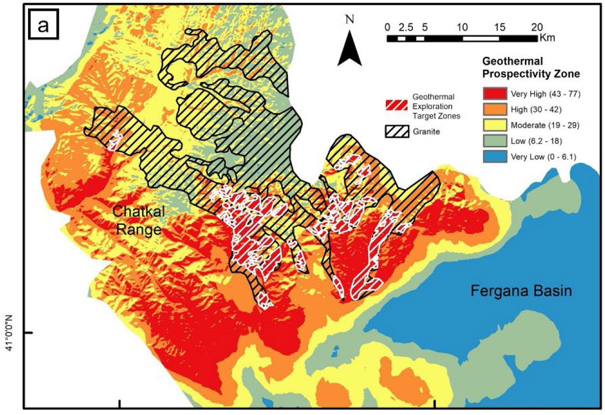
- Eleven geothermal exploration target zones, all in granite in the Chatkal Range; ten in the south-east.
- Largest zones about 44.2, 18.8 and 15.3 km²; seven small zones of 0.6–2.7 km².
- 4,374 lineaments mapped automatically and 5,300 by hand; average length about 690–700 m.
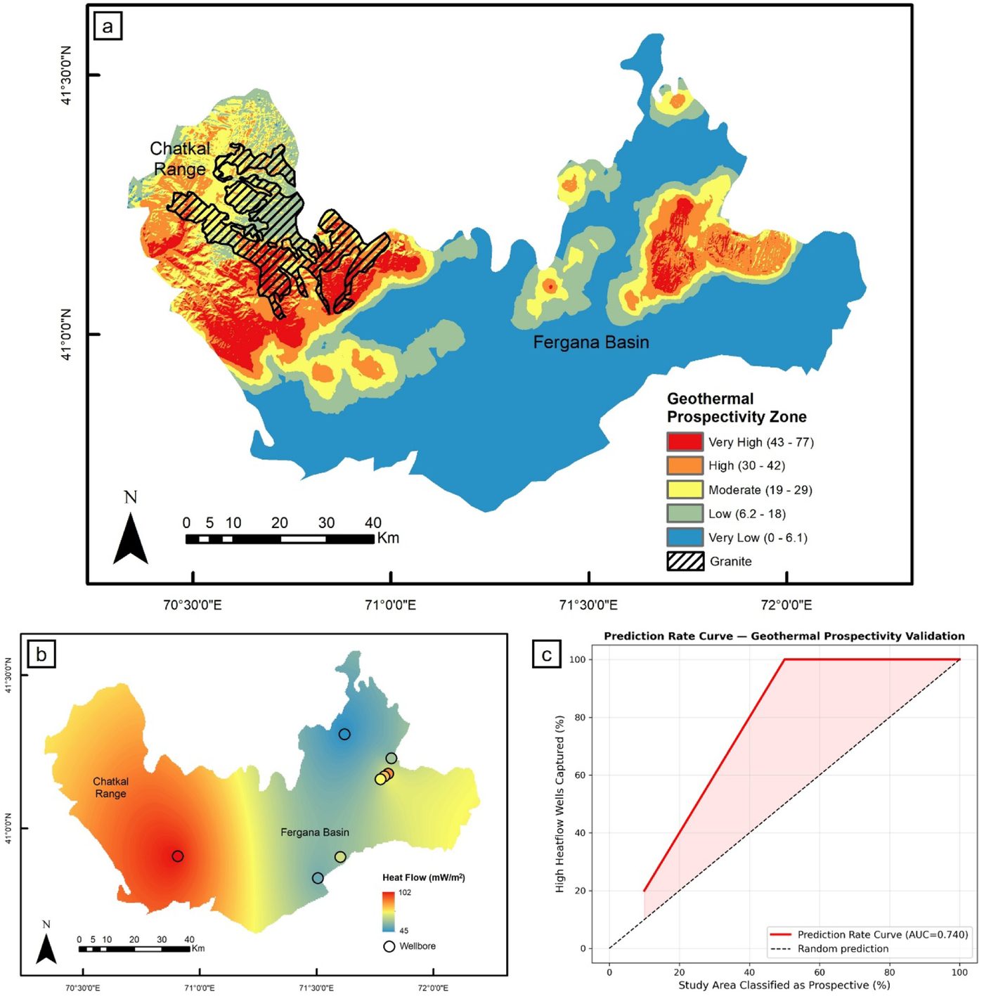
- Heat flow in the ten wells listed 45–102 mW/m²; area under the prediction-rate curve 0.74.
- Data: SRTM elevation and Landsat 8 thermal band, both 30 m and freely available.
Keywords
- Remote sensing
- Geothermal
- Lineament
- Land surface temperature
- Fergana Valley
Summary
The study area covers the Fergana Basin and the Chatkal Range in the western Tian Shan. The basin is filled with Cenozoic sediments; more than 80% of the exposed rock in the Chatkal Range is Carboniferous intrusive rock. The authors treat the area as a possible amagmatic geothermal system, in which heat rises along deep faults rather than from magma.
From a 30 m elevation model (SRTM), the authors mapped lineaments, the straight surface features that mark faults and fractures: 4,374 by an automatic method and 5,300 by hand. They combined the two density maps, keeping only areas dense in both. Few lineaments show in the basin, where thick Quaternary sediments hide the structure; most lie in the Chatkal Range and the eastern basin.
Land surface temperature came from Landsat 8 winter scenes (December to February, 2023–2024, less than 5% cloud), chosen to reduce the effect of the sun. The warm western basin was put down to bare soil rather than geothermal heat. In the Chatkal Range, which is mostly cold and snow-covered, the authors see the local warm anomalies in the south as possibly geothermal.
Fuzzy logic combined fault density and temperature anomaly into a prospectivity map, which was then limited to granite, a rock that produces heat by radioactive decay and can hold fluids in its fractures. The result is eleven exploration target zones in the Chatkal Range: ten in the south-east and one of 1.7 km² in the north-west. The three largest, of 15.3, 18.8 and about 44.2 km², lie close to the North Fergana Fault, where heat flow of 80–90 mW/m² has been reported (Zui et al., 2020); the authors rank them as the most favourable.
Tested against heat flow measured in wells (those on the low alluvial plain were left out), the map scored an area under the curve of 0.74, which the authors call acceptable. They stress that the zones are preliminary targets, not confirmed resources: there are no hot springs in the area, the work has not been checked in the field, by drilling or by water chemistry, fractures may be sealed by minerals, and slope and snow can affect surface temperature. They call for field mapping, alteration and geochemical surveys, gravity and other geophysical work next.
Figures (2)
How to cite
Arya Pradipta, Izzul Qudsi, Sherzod Allaev and Daffa Arrofi (2026). Identifying geothermal prospectivity zones in the Fergana Valley through lineament density and land surface temperature anomalies. Geothermics, 143, 103883. https://doi.org/10.1016/j.geothermics.2026.103883