Journal articleOpen access
Geothermal characteristics of Jurassic strata of the South-Western Gissar petroleum region
Геотермическая характеристика юрских отложений Юго-Западного Гиссарского нефтегазоносного региона
Highlights
- Data from 86 prospecting and exploration wells.
- Temperatures of 34–137 °C in the Jurassic water-bearing rocks.
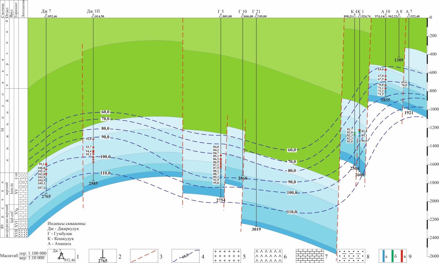
- Geothermal gradient of 1.47–3.85 °C per 100 m; geothermal step of 26–68 m per °C.
- Highest temperature in the region: 137 °C, in well 1P of the Gumbulak field, at 3,850–3,868 m.
Abstract
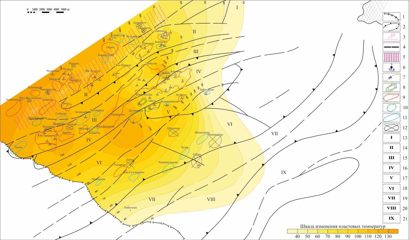
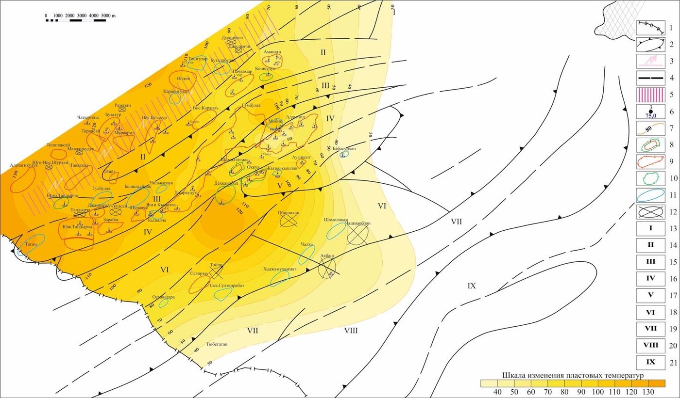
The identified industrial hydrocarbon accumulations of the South-Western Gissar petroleum region (Republic of Uzbekistan) are stratigraphically associated with sequences of the Middle-Upper Jurassic carbonate strata. The geothermal characteristics of groundwater in the Jurassic strata have a wide range of variations from the southwest to the northeast, depending on the depth of the sedimentary cover. This is also associated with the lithological-stratigraphic and tectonic structure of the region. The features of changes in geothermal conditions with depth and area are considered. A comparative analysis of geothermal indicators is carried out: temperature, geothermal gradient, geothermal stage. Based on factual materials, schematic maps of changes in modern temperatures in the regional plan were constructed for the XVa and XV levels of the Jurassic strata of the South-Western Gissar petroleum region.
English abstract from the journal’s website. The authors’ abstract, reproduced under CC BY 4.0.
Keywords
- Jurassic strata
- carbonate strata
- geothermal gradient
- geothermal stage
- South-Western Gissar petroleum region
- Uzbekistan
In plain English
Written for petroleum geology, this paper describes the temperatures of groundwater in the Jurassic rocks of the South-Western Gissar region, which host the region’s oil and gas deposits.
Temperature, geothermal gradient and geothermal step vary widely from south-west to north-east, with the depth of the sedimentary cover, the type of rock and the tectonics. The author maps present-day temperatures for two Jurassic horizons, XVa and XV.
Figures (3)
How to cite
A. T. Mukhammadiev (2025). Geothermal characteristics of Jurassic strata of the South-Western Gissar petroleum region. Neftegazovaya Geologiya. Teoriya i Praktika, 20(3), article 34. https://ngtp.ru/rub/2025/34_2025.html
In our news
 Temperatures and geothermal gradients of the Gissar region’s Jurassic strata22 September 2025