Journal articleFree to read
Change in groundwater regime Middle Zeravshan oases under the influence of irrigation
Ўрта Зарафшон воҳаларида грунт сувлари режимининг суғориш таъсирида ўзгариши
- National University of Uzbekistan, Tashkent, Uzbekistan
- Samarkand State University, Samarkand, Uzbekistan
Highlights
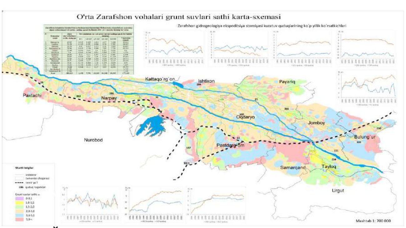
- Water table: 4–8 m deep in the Samarkand oasis on average, 3–7 m in Narpay and Pakhtachi districts, 10–25 m next to the foothill plain.
- Land with the water table within 3 m: 41.1–47.4% of irrigated land in Narpay, Kattakurgan and Ishtikhon districts; 6.9% in Urgut district.
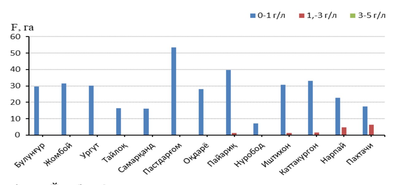
- Mineralisation: under 1 g/L in the eastern districts, 1–3 g/L in the central ones, 3–5 g/L on small areas in the west.
- Well 313 in the west: 513 to 3,201 mg/L; well 221 in the east: 253–362 mg/L, 1990–2021.
- Return flow through collectors and drains: more than 2 billion m³ a year; more than 3,000 km of collector and drainage canals.
Keywords
- oases
- irrigated lands
- reclamation expedition
- groundwater regime
- mineralization
- ionic composition
- gypsum layer
Summary
The authors analyse records of the water table and groundwater mineralisation in the irrigated oases of the Middle Zarafshan for 1990–2021, from observation wells and land reclamation surveys. In the Samarkand oasis the water table lies on average 4–8 m deep, 7–10 m on higher ground and the third river terrace, and 10–25 m next to the foothill plain; in Narpay and Pakhtachi districts of the Kattakurgan oasis it lies 3–7 m deep.
Irrigation has raised the water table and its mineralisation, increasingly from east to west. In Narpay, Kattakurgan and Ishtikhon districts, land with the water table within 3 m of the surface makes up 41.1–47.4% of irrigated land. In two wells in Nurobod district the water table rose from 18 m to 1.5 m below ground; near the river some wells show falling levels, which the authors link to sand and gravel extraction deepening the riverbed.
Mineralisation stays below 1 g/L under irrigated land in Bulungur, Jomboy, Urgut, Tayloq and Samarkand districts, reaches 1–3 g/L in Pastdargom, Nurobod, Ishtikhon, Oqdaryo and Payariq, and 3–5 g/L on small areas of Pakhtachi, Narpay and Kattakurgan. In one well in the west it rose from 513 to 3,201 mg/L, while in a well in the east it stayed between 253 and 362 mg/L. The authors relate the westward increase to gentler slopes, slower groundwater flow and salts dissolved from gypsum- and carbonate-rich rocks of the foothills.
Figures (2)
How to cite
B. E. Adenbaev and Kh. A. Baratov (2023). Change in groundwater regime Middle Zeravshan oases under the influence of irrigation. Gidrometeorologiya va atrof-muhit monitoringi (Hydrometeorology and Environmental Monitoring), 2023, No. 1, pp. 43–53. https://nigmi.uz/portfolio/hydrometeorology-and-environmental-monitoring-scientific-journal-%e2%84%96-1-2023-y/